|
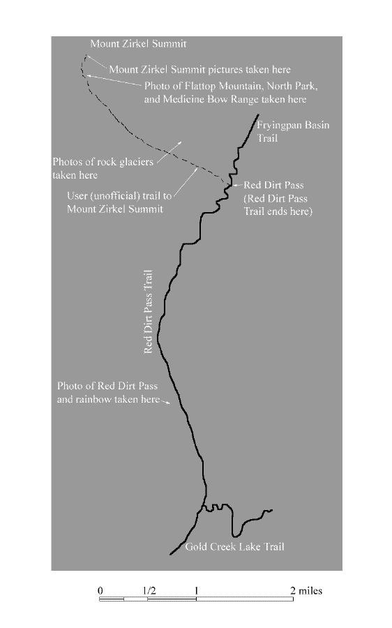
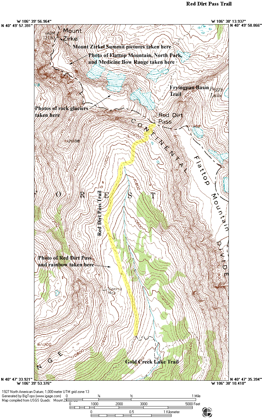
The map above is provided to minimize download time. To see the full topographical version of the map, click on the thumbnail below.
Click on the thumbnails below to view full size photographs.
|
|
|
|
|
|
 |
|
|
Rainbow over Slavonia
|
|
This picture was taken near the abandoned Slavonia Mine.
|
|
|
|
|
|
|
 |
|
|
Red Dirt Pass
|
|
This photo was taken near the abandoned Slavonia Mine.
|
|
|
|
|
|
|
 |
|
|
Rock Glaciers in Fryingpan Basin
|
|
This shows the active rock glaciers east of Mount Zirkel in Fryingpan Basin.
|
|
|
|
|
|
|
|
|
|
 |
|
|
Flattop Mountain, North Park, and Medicine Bow Range
|
|
This picture was taken near the Mount Zirkel Summit.
|
|
|
|
|
|
|
 |
|
|
View south from Mount Zirkel Summit
|
|
This picture shows Lost Ranger and Mount Ethel Peaks as well as The Dome, all located in the southern section of the wilderness.
|
|
|
|
|
|
|
 |
|
|
Big Agnes Peak
|
|
This is Big Agnes Peak viewed from the Mount Zirkel Summit.
|
|
|
|
|
|
|
|
|
|