|
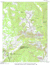
The map above is provided to minimize download time. To see the full topographical version of the map, click on the thumbnail below. Be aware that the file is about 1.1 megabytes and will take a long time to load on a dialup modem.

Click on the thumbnails below to view full size photographs.
|
|
|
|
|
|
 |
|
|
Boulder along trail in North Fork Valley
|
|
|
|
|
|
|
|
 |
|
|
North Fork of Elk River Valley
|
|
|
|
|
|
|
|
 |
|
|
Big Agnes Peak
|
|
This picture of Big Agnes Peak was taken along the climb to the Continental Divide.
|
|
|
|
|
|
|
|
|
|
 |
|
|
Sawtooth Range
|
|
This picture of the Sawtooth Range was taken from Encampment Meadows.
|
|
|
|
|
|
|
|
|
|
|